On January 11, an ERCOT advisory was expanded and was issued for the predicted extreme cold weather event for the ERCOT Region Sunday, January 14 through Wednesday, January 17. This messaging is a part of ERCOT’s standard operating procedures put in place after Winter Storm Uri in 2021, and is issued three days ahead of severe weather. The Railroad Commission has issued an advisory to oil and gas pipeline operators warning of the winter weather conditions beginning this weekend. The RRC notes wind chill values by Monday morning could be below zero in the Panhandle and across West Texas. For Central Texas, North Texas, West Central Texas, wind chill values will be in the single digits.
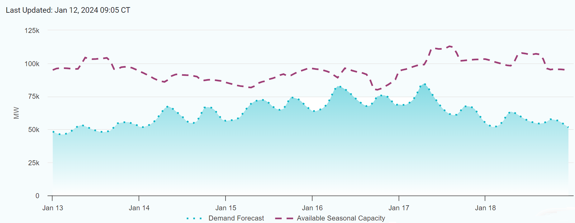
The chart below depicts ERCOT’s 6-day supply and demand forecast. Of note, this chart does not include capacity available from demand response programs and is subject to change as the weather event gets closer.

Previously, On January 10, ERCOT issued a Weather Watch for January 15-17. This notice is an advance notification of forecasted significant weather with higher electrical demand and the potential for lower reserves. ERCOT notes at this time, grid conditions are expected to be normal, and there is not a current expectation of an energy emergency. The first notice was issued on January 8 for the predicted extreme cold weather event for the ERCOT Region Monday, January 15 through Wednesday, January 17. This type of notice is issued five days ahead of severe weather.
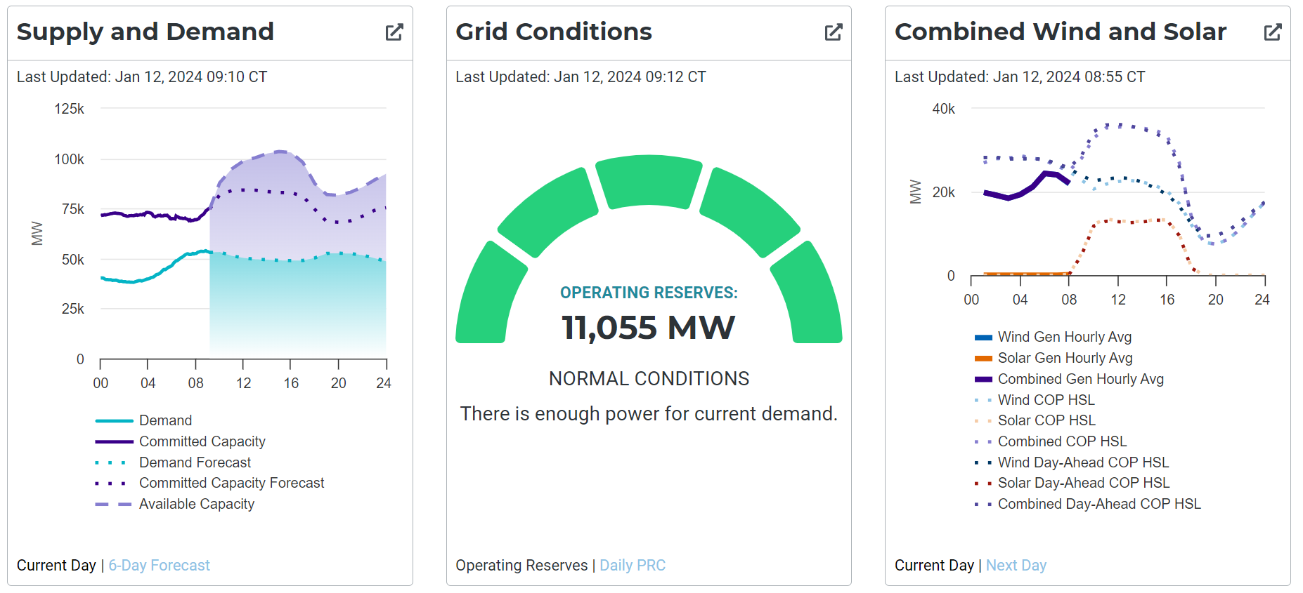
More information on current grid and market conditions is depicted by ERCOT’s dashboard which can be found here on ERCOT’s website. Below reflects the current grid/market conditions. Additionally, Texans can monitor highway conditions here on the Drive Texas webpage.

The RRC advises all operators to monitor and report road conditions during the weather event. Operators can report road conditions online here.
The National Weather Service Forecast as of Friday Morning is below. This situation will continued to be monitored and any updates or changes to these and other areas can be found by visiting the National Weather Service’s webpage here.
NWS Midland/Odessa – Wind chills will be in the single digits across the Permian Basin on Sunday morning. Monday morning will be even colder with very cold wind chills stretching down past Marfa. Tuesday morning features the most dangerous wind chills with most locations seeing wind chills below 0 and even -10 to -15 degrees.
NWS Amarillo – Several days below freezing are expected across the combined Panhandles starting Saturday, and won’t recover until Wednesday afternoon. Morning low temperatures will be dangerously cold, especially for northern areas, with even colder wind chills.
NWS Austin/San Antonio – A strong cold front will move through the region Sunday night bringing the coldest air of the season and there is a chance for some light freezing rain. Most places will see only a few hundredths of an inch, with expectations of only minor impacts.
NWS Fort Worth/Dallas – The timing of wintry precipitation has been pushed slightly later and is now expected Sunday night through Monday. Amounts are still forecasted to remain relatively low. However, anything that falls will likely result in impacts given the very cold air that will already be in place. There is a medium to high chance of mostly snow near the Red River and a low to medium chance of a wintry mix or freezing rain elsewhere. Impacts to travel, power, and broken tree limbs are all possible with this event.
NWS Houston/Galveston – Hard freezes (temperatures <24 degrees) will be a threat for many parts of Southeast Texas Sunday night through Tuesday night. Expect some long durations of subfreezing temperatures. Chances for light freezing rain or drizzle are on the low side with small possibilities Sunday night or Monday for parts of the area.